


Neretva
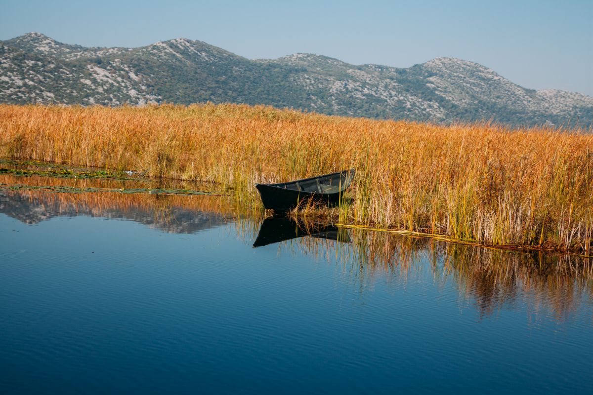
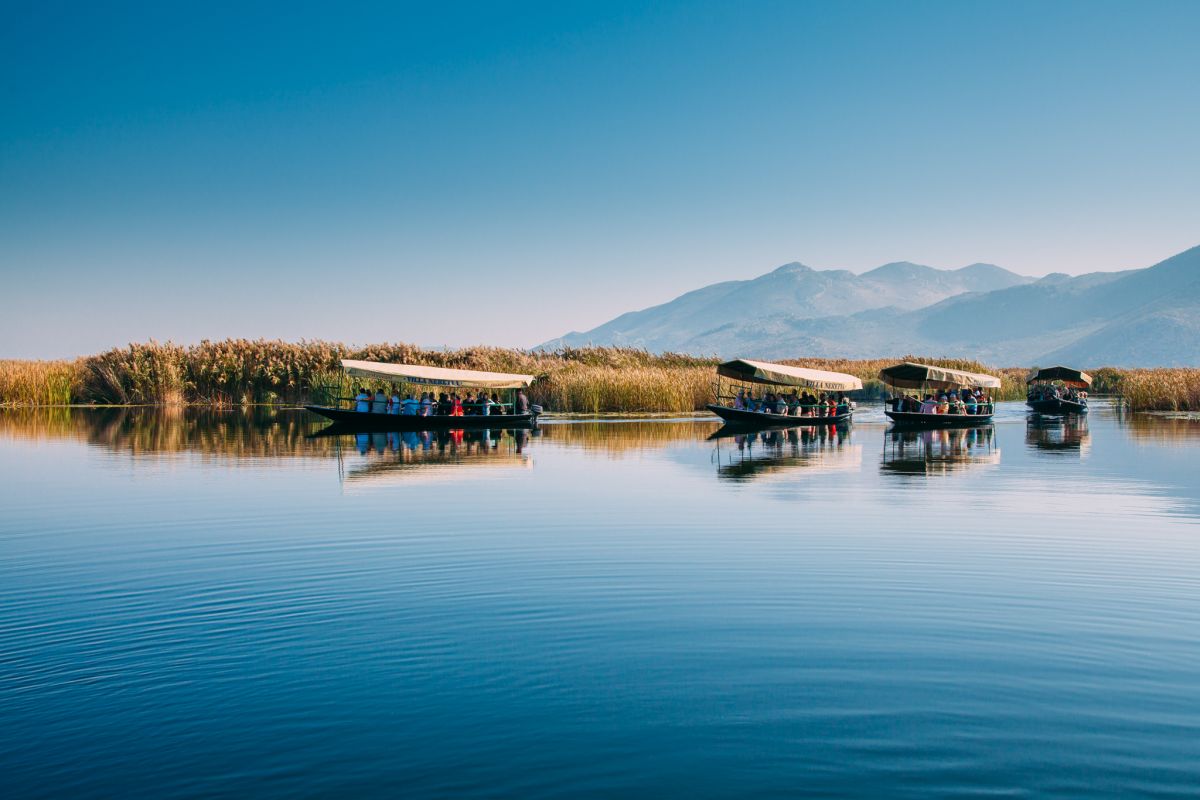
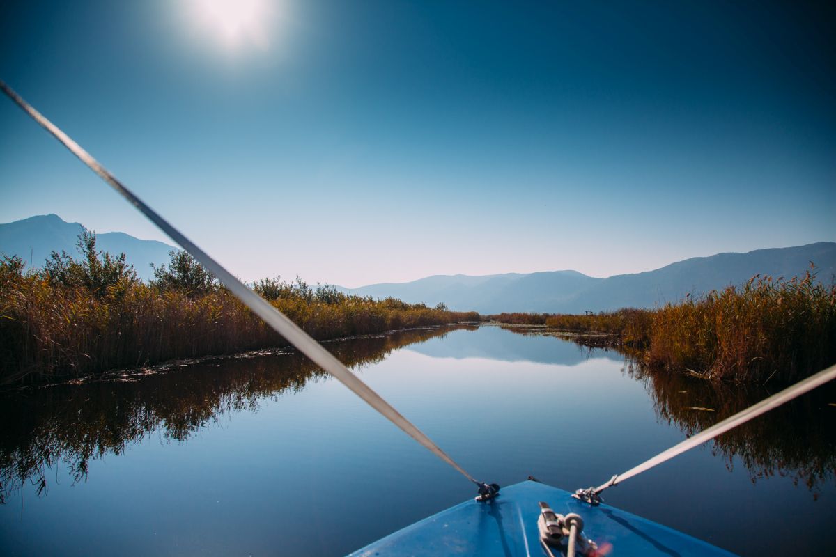
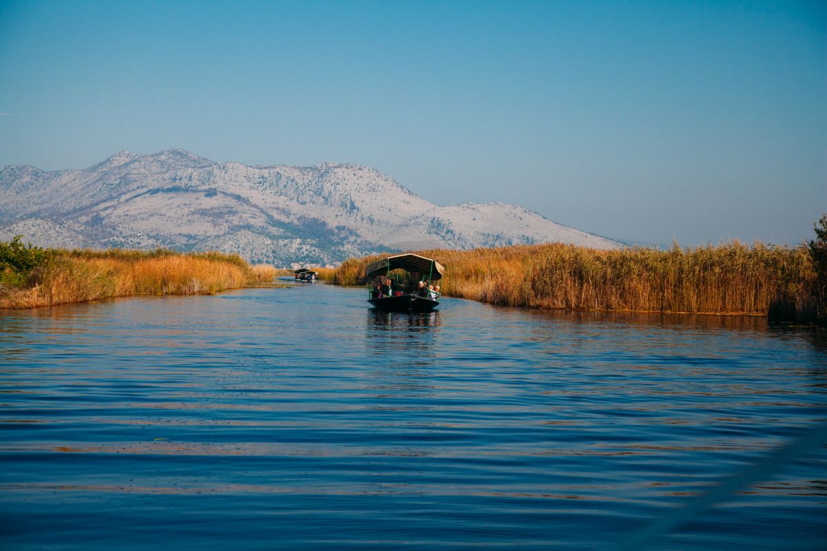
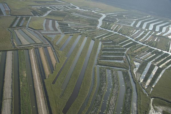
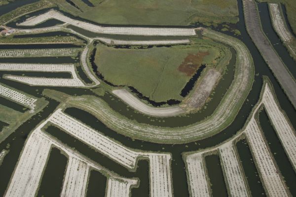
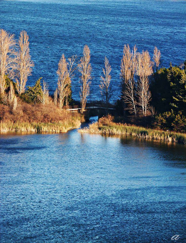
The valley of Neretva is a land you dream of, an untouched part of nature where you’ll feel the call of unbridled nature, as well as welcoming hosts. The ride on narrow canals and backwaters of the Neretva in the traditional boat is a unique experience which will offer you a feeling of nirvana.
The boat of Neretva meant the life and nowadays it means pride and an indelible trace of tradition which fascinates, again and again, every visitor to our valley.
The boat will be guided by your host who will make you familiar with the life in Neretva, show you how people of Neretva fish and cultivate citrus fruits as their symbols (mandarins, figs, grapes).
Enjoy an authentic experience, revealing small secrets of the widely-known local delicacies, toasting you with Neretva wine from wooden jugs and, of course, singing to your hearts delight. In that perfect labyrinth of canals adorned with beautiful water-lilies, unique samples of birds live in their hidden abodes, covered by bulrushes and reeds.
And finally, the secret of the sunken town – the lake of Kuti.


Baćina
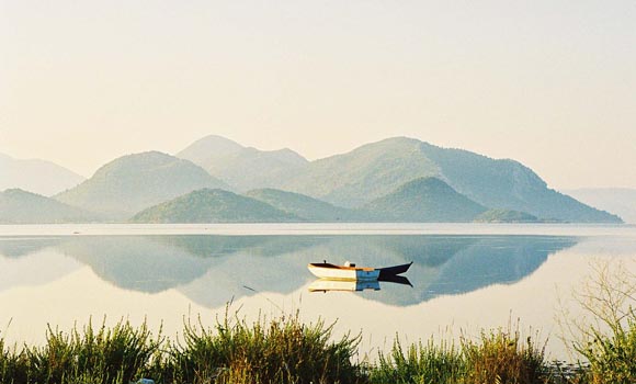
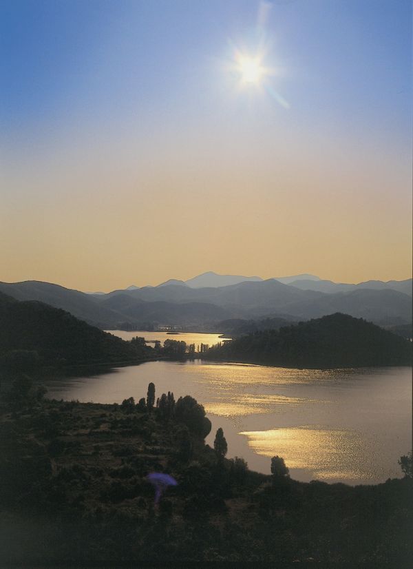
The town of Baćina is located in the southern part of Croatia in the Dubrovnik-Neretva County. This is an area 2.5 kilometres west of the city of Ploče, situated along the slopes of the Biokovo mountain range and is exactly at the half-way point between Split and Dubrovnik on the Adriatic Highway. The Baćina lakes are located near the town of Baćina. This is a series of six connected and one separate lake: Oćuša, Crniševo, Podgora, Sladinac, Vrbnik, Šipak and Plitko lakes.
Their depths ranging from 5 to 35 metres, they are freshwater lakes and their source is directly connected to the sea. The lakes themselves are the result of a cryptodepression. A 2 kilometre tunnel was dug from the Vrgorac fields to the Baćinska lakes in order to drain the Vrgorac and Staševac fields from excess water in order to prevent flooding.
Information
Ploče Tourist Board
Vladimira Nazora 26
20340 Ploče
tz.ploce@email.t-com.hr
www.infoploce.hr
Tel/Fax: +385 (0) 20 679510

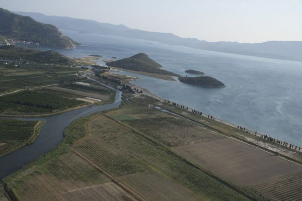
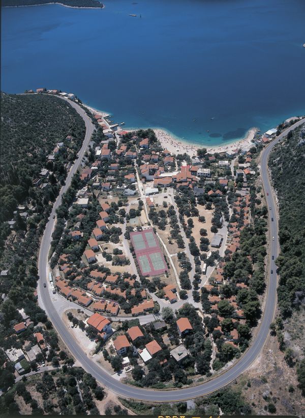
Klek
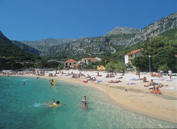
The town of Klek is situated in the Mali Ston bay, southeast of the mouth of the Neretva River, just opposite the Pelješac peninsula. Its waters are abundant in fish. The area has a rich history, it was once part of the famed Dubrovnik Republic, and today is home to some 80 residents who make their living primarily from growing fruit, vegetables and olives, fishing and tourism.
Information
Slivno Tourist Board
Duboka 112
20356 Klek
info@tzo-slivno.hr
www.tzo-slivno.neoinfo.hr
Tel/Fax: +385 (0) 20 691047
Kula Norinska
In the beginning it was called Bobalj, after the mountain of the same name above the village, where the remnants of Illyrian stone grave mounds can still be seen. In the entire municipality, only Krvavec II is younger than Kula. The fortress Smrdan-grad and the monumental Kula Norinska (tower), several stories high are remnants of Turkish times. They were built at the beginning of the 16th century where the small river Norin flows into the Neretva River. The tower served as a defence against the charge of Venetian ships into the valley. It was used for military purposes until the 19th century, when it was adapted into a windmill.
Due to the Turkish fortress, the tower received the name Kula (tower), and Norin comes from the river of the same name which drains into the Neretva River here. That is how Bobalj became Kula Norinska or Torre di Norino, as the Venetians called it. In 1993, during the formation of counties and new municipalities, the unit of self-administration received its name from this settlement, where its administration is centred.
Information
Metković Tourist Board
Stjepana Radića 1
20350 Metković
turisticka.zajednica.metkovic@du.t-com.hr
www.tzmetkovic.hr
Tel: +385 (0) 20 681395
Fax: +385 (0) 20 684772
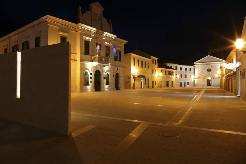
Metković
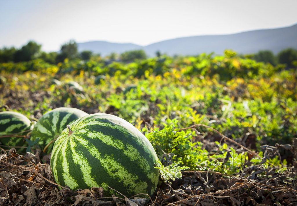
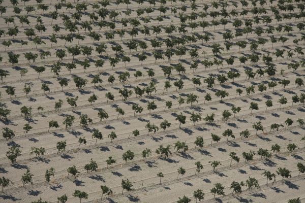
Where hills merge with a fertile valley, where a green river and mystical swamps combine with clear blue sea, that is where you find Metković. Here you will feel the call of the wild, get to enjoy in juicy fruit, especially the tangerines and meet your welcoming hosts to have a good time!
Located in the valley of the Neretva river, open towards the sea, Metković offers great possibilities for enjoying your vacation. Traditionally turned towards agriculture because of the rich river delta known for its plantations of tangerines and other fruit and vegetables, it is a natural phenomenon and you can also enjoy boat rides ( Neretva photo safari) and in traditional specialties ( eel and frog).
Of interesting events to note are the city features. During May there is the traditional folklore event “Na Neretvu misečina pala”, or “Moonlight falls on Neretva”, while July is rerserved for traditional mullet fishing and the Cipolijada, a contest of jumping into the Neretva. There’s also the Roman Night in Narona, which will transport you back in time to Roman times, where gladiator fights and slave markets were prominent.
A part of the Day of the Neretva Principality in August is getting to know traditional crafts and village games, watch exciting contests and costume plays. The traditional Neretva ship marathon, “Maraton lađa”, where around 30 crews from the Neretva valley and abroad compete, is held on the 2nd Saturday in August.
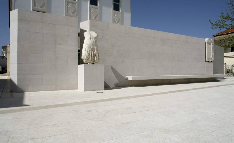
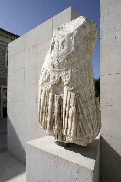
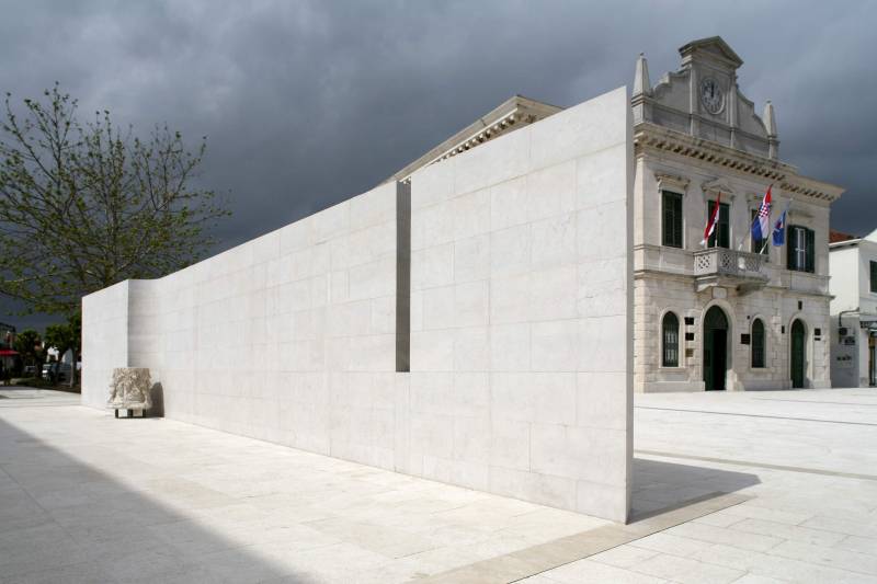
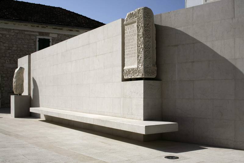
The remains of the city of Narona, today’s Vid are 4km southwest of Metković, where the Archeological musem Narona is built, as the first “in situ” museum in Croatia. Built on the locality of an antique temple dedicated to the 1st Roman emperor Augustus, it shows a unique collection of antique statues made sometime in the 1st century B.C. The Archeological museum Narona is a unique and unavoidable destination for all lovers of culture, art, history and archeology.
The best example of a rich and diverse bird population of the Neretva delta can be observed in the ornithological collection in Metkovič. Founded by famous Croatian ornithologist Dragutin Rucner. Unfortunately, the dalmatian pelican, griffon duck and marbled teal are gone, but even today we can see bitterns and ferruginous ducks nesting in the Neretva delta. The delta is an important resting place for millions of migratory birds but also a popular destination for many nature lovers. Today, the ornithological collection is part of the Natural History Museum in Metković.
In Jama and Predolac you can meet the unique cave shellfish “Congeria”, a living fossil, a tertiary relic and unique species to the Dinarid Alps. You can also meet many other animal species living exclusively underground, but those who live in surface waters. All this in one locality that’s unique in the world will provide a unique experience to all those visiting this area.
Information
Metković Tourist Board
Stjepana Radića 1
20350 Metković
turisticka.zajednica.metkovic@du.t-com.hr
www.tzmetkovic.hr
Tel: +385 (0) 20 681395
Fax: +385 (0) 20 684772

Opuzen
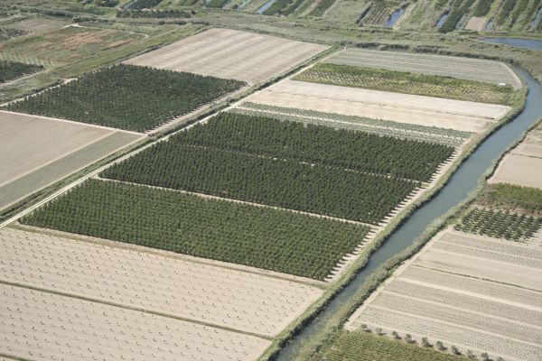
It is a small town on the left bank of the Neretva River, 12 kilometres upstream of the river’s mouth. The main economic activities are agriculture, fruit growing (southern fruits: mandarin oranges, figs and others), fruit and vegetable processing and fishing in the Neretva River, its channels and lakes in the delta. It is positioned on the rail line and crossroads of the Split-Dubrovnik highway (M2, E65) and roads for Metković and Mostar (M17.03, E75). In the Middle Ages, it was called Posrednica. In the 14th century, it was part of the Dubrovnik Republic (burnt down in 1472); from the end of the 15th century, the Kos fortress stood here. In 1685, the Venetians erected their own fortress (Fort Opus) in the same spot.
Opuzen is a frequent excursion destination for those staying on the Adriatic coast, as well as for sport fishermen. The fishing conditions on the Neretva and in its channels and the lakes in the delta are excellent. The town is also well known for the quality of its fruit, in particular mandarin oranges and kiwi fruit. Local delicacies are offered in Opuzen restaurants (freshwater eels, etc.).
Information
Opuzen Tourist Board
20355 Opuzen
info@tz-opuzen.hr
www.opuzen.hr
Tel: +385 (0) 20 671651
Fax: +385 (0) 20 671620

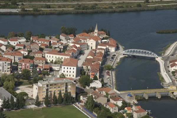
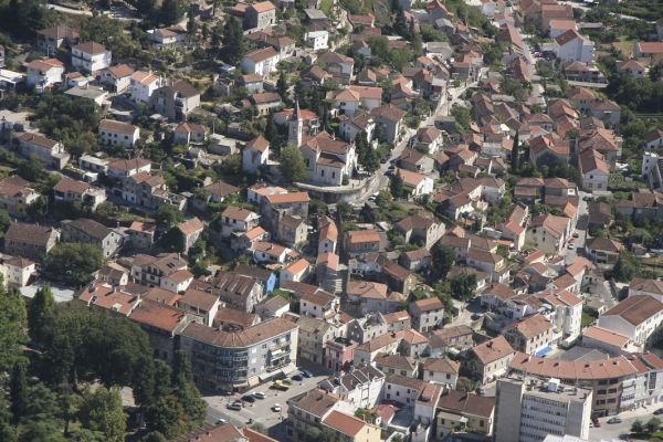
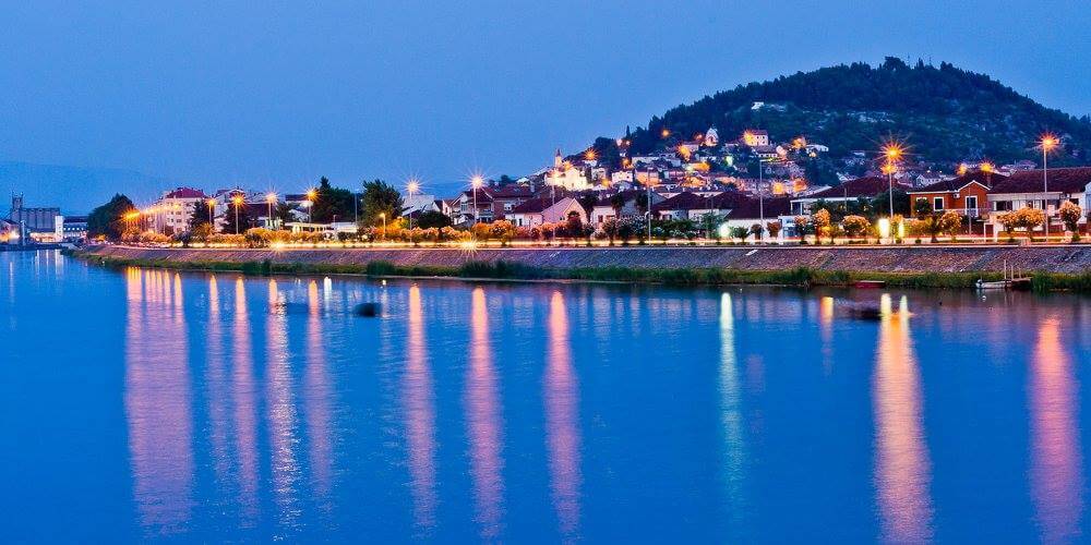
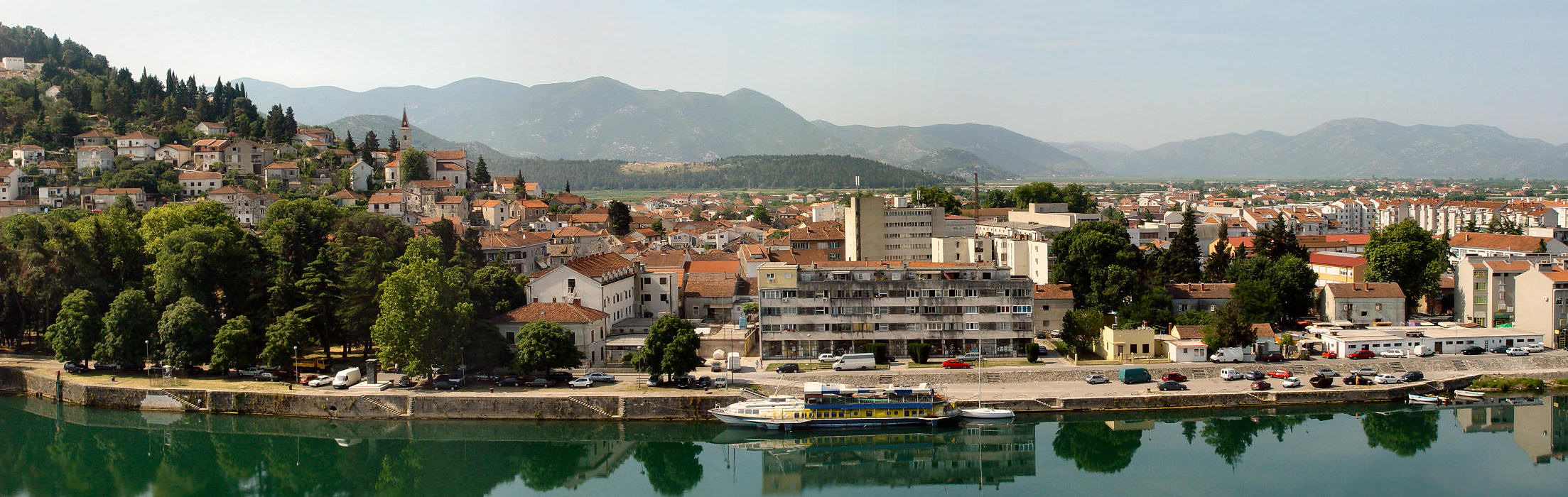
Ploče
The city of Ploče is the youngest city on the Adriatic coast, and next to the port of Rijeka is the largest cargo port in Croatia. The city is situated several kilometres west of the mouth of the Neretva River, at the point where its delta touches the karst mountain regions. The most important characteristic of Ploče is that it is at the end of the centuries long natural course of the Neretva River Valley, which ties the central regions of the neighbouring Republic of Bosnia Herzegovina with the Adriatic Sea.
The city is also positioned at the half-way point between Split and Dubrovnik on the important Adriatic highway. Near to the city are the Baćina lakes, situated along the spur of the Biokovo mountain range. There are regular ferry connections between Ploce and Trpanj on the Pelješac peninsula and train connections to Mostar.
Information
Ploče Tourist Board
Vladimira Nazora 26
20340 Ploče
tz.ploce@email.t-com.hr
www.infoploce.hr
Tel/Fax: +385 (0) 20 679510
Slivno
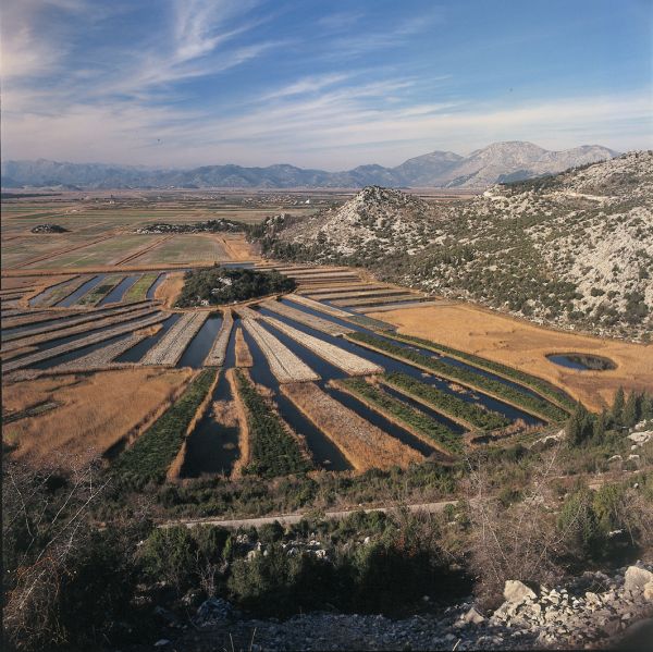
Slivno was named after a similar peninsula which is on its northern and eastern sides immersed into the Neretva swamp, on its north-western side it is surrounded by tangerine plantations and on the southern and south-western sides it is surrounded by the sea. Working on it patiently for millennia, the sea, the sun and winds have created beautiful bays and beaches. The weak tourist promotion of this part of Croatian south has made it ideal for tourists who want a holiday without a big crowd. Mainly refering to either boat owners who search for small secluded coves or sport-fishing amateurs delighted by the rich fauna at the River Neretva mouth which is also known for the mixture of salt and fresh water.
Neretva valley – In ancient times the whole valley of the Neretva River up to the present borders of Croatia and Bosnia used to be under the sea. Since the greater part of the valley was meliorated, today, instead of the sea or wetlands, what you can see there are plantations of tangerine, vine, citrus olive and fig trees.
The Slivno municipality is located at the southern end of the Lower Neretva area. Stretching over about 55 km2, which makes only 3% of land area of Dubrovnik-Neretva County it is considered a smaller municipality.
The Lower Neretva area is characterized by diverse relief with many picturesque landscapes. What makes this nature so attractive is the mesh of river and sea, plains and rocks, lakes and swamps. Former wetland was replaced by a cascade landscape, becoming the most valuable agricultural part of the Slivno municipality . Along the edge of the hill there are still some round sources which, due to their first-class aesthetic value, draw attention of many passers-by.
The municipality has a spatial share of all three specific physiognomic units which are typical of this region. Karst limestone formations south of the Mala Neretva River belong to the Slivno municipality and is therefore also called Slivno. Vegetation in this area consists of karst landforms such as stones, depressions, sinkholes, caves and coves. The highest point of Slivno is Daska with an altitude of 563 m.
The tidewater of the municipality, as well as of the whole Croatian coast, is geologically young because it was created by the sea level rise caused by melting of Pleistocene glaciers. Transgression of the sea caused the sinking of the entire lower course of the Neretva River creating numerous bays, peninsulas and several smaller islands, which made the coastline even more indented. 22 km long coastline between the mouth of the Mala Neretva River and the bay Moračne also belongs to the municipality. Most of the coast of the municipality is not touristically used despite its picturesque bays and sandy beaches, and the fact that it is quite far away from the larger settlements guarantees a peaceful and pleasant holiday.
The main road running through the Municipality Slivno is the Adriatic highway which gradually rises from the bridge in Mala Neretva towards the karst area, stretching along its edge to Slivno Ravno. Near the settlement of Raba it descends towards the sea coast near the village Duboka. It goes on to follow the coast to Moračna bay after which it leaves the municipality area.
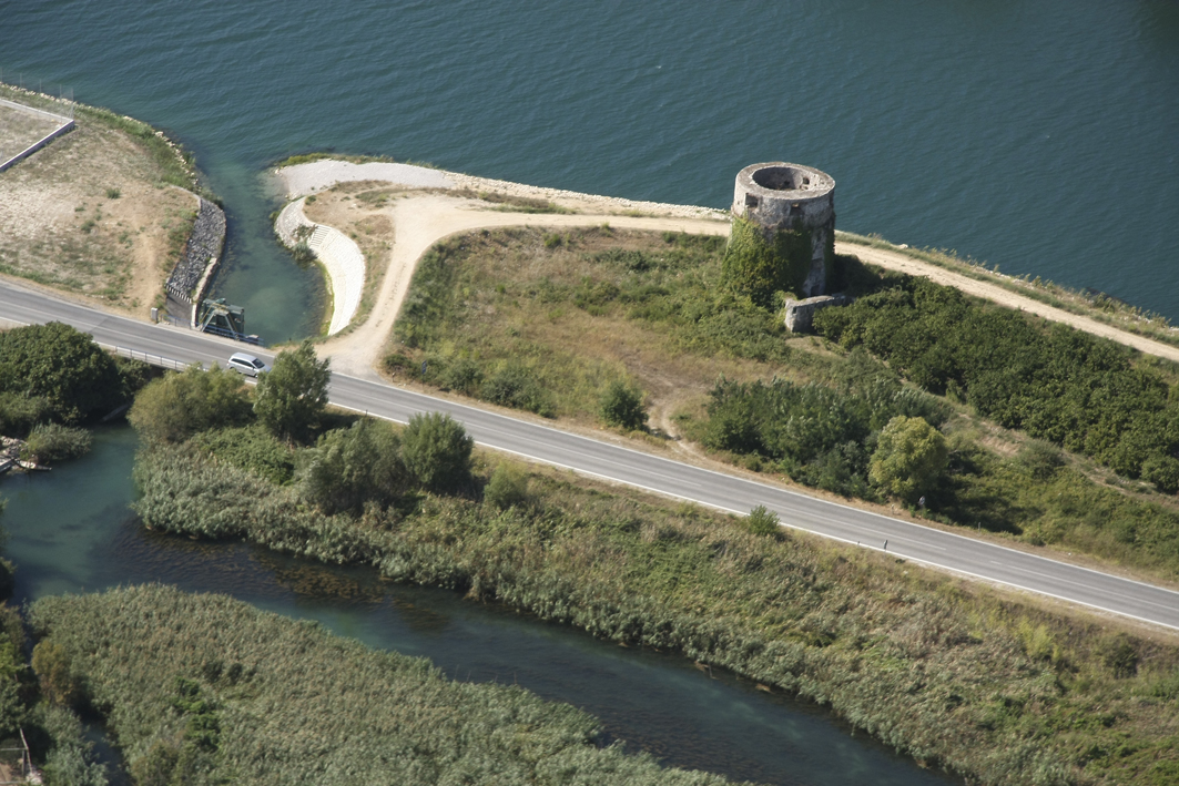
Today in the Slivno municipality there are remains of cities and other various settlements, forts, towers, sacred objects, as well as some protected architecture. They are all part of the cultural heritage of the area. Since the culture and tourism have become inseparable, all the Neretva monuments have certain touristic value. Despite the scientifically-based fact that the Slivno municipality has a long settlement tradition no archaeological sites have been systematically studied. Therefore, the prehistoric monuments are poorly known and still no such site has been registered as a protected monument. Tombstones are the most numerous and the most widespread medieval monuments in the entire Slivno municipality. South of Opuzen, on a hill, there are some remains of fortifications Brstanik which along with Nonković tower from the 17th century in Klek draws great tourists attention.
Over the bay and the resort Klek, on a steep hill, there are the ruins of Smrdan city. Along the southern ramparts you can see the Church of St Rocco and the Great Lady from the 18th century. From the top of the fort there is a panoramic view of Klek and a part of the archipelago. In front of the mouth of the Mala Neretva River there is an islet Osinj with the church of St John Baptist on it that, judging by the intermediate features of Romanesque-Gothic style, dates back to 14th -15th century. On the southern edge of the limestone Neretva Delta, which nowadays belongs to the almost-deserted settlement of Slivno called Ravno, a stone Church of St. Stephen was built in the year 1900.
The church of Our Lady of Health in Vlaka is the first consecrated building in the independent Republic of Croatia.
The greatest touristic importance of the municipality Slivno belongs to the coastal settlements. Along the coast from the northwest to the southeast lie the following towns:
Blace. Blace village is located near the estuary of Mala Neretva River. Here you will find mostly domicile inhabitants that at this splendid position have started an intensive construction of weekend houses. All accommodation is private.
The next place is Komarna, which is, at least for now, the only tourist resort on the Riviera with the prospect of becoming a significant tourist destination of the weekend and apartment type.
After Komarna, following the beautiful bay of Duboka we come across a village sharing the same name. In the winter and summer months it offers accommodation in private apartments and first category rooms. About 700m away there are small places called Repić and Radalj, connected with a beautiful tranquil bay. The places also provide accommodation for guests in private apartments. Radalj is on its other site connected to a place called Klek. Klek is a picturesque place situated along the main road at the end of the municipality. The tourist resort Klek has some facilities such as a miniature golf course, tennis courts, parks for children and a beautiful beach that stretches through the whole place.
The last bay in the Slivno municipality – Moračna, borders with the other state.
Information
Slivno Tourist Board
Duboka 112
20356 Klek
tzslivno@gmail.com
www.tzo-slivno.neoinfo.hr
Tel/Fax: +385 (0) 20 691047
Vid
The village of Vid sprouted from the remains of the ancient Roman city of Narona. The tame scenery fills the green valley where the crystal clear Norin River meanders, whose waters supply a good portion of the Neretva valley, Pelješac, Mljet and Korčula. The Romans surely knew how to choose the best location. From the hilltop, we can glimpse one of the most beautiful views of the Neretva valley. To the southeast on a similar hill, Gabela is nestled where the Mexican hotelier Salinas Price once saw Troy. Towards the west, the view drops onto an untouched wetland overgrown in reeds where Rujnica Mountain looks over, and under it are the Norinska tower, and the villages Matijevići, Momići and Podrujnica. The old Vratar fortress towers over the northwest; this is the gateway to the valley. If we turn south, we see Metković, a town which came down from Predolac hill into the valley and spread its points out to the four corners of the world. A geographically straight road connects it to Vid.
In the immediate vicinity of Vid we can find special ornithological reserve, Pod Gredom and Prud, which are the last remnants of the mediterannean swamp area in the part of the Meditarannean. Because of the swamp vegetation and the roost places of many birds they have been declared a special ornithological reserve in 1965. The area of the Neretva delta has been added to the international Ramsar swamp list in 1993, and has been declared part of the Natura 2000 as an important bird preservation area – POP, and an important area for birds and local habitat types – POVS
The Church of St. Vid, one of the oldest in the Neretva Valley, arose on the location of an early Christian basilica from the 5th century. The early Christian basilica at St. Vid is one of the three known basilicas of Christian Narona. If you take a walk along the narrower part of the site, the part going along the right side of Norin that has been mainly built during the 17th century that represents an untouched urban complex of local architecture, you’ll turn into an explorer that will find marvelous parts of the local history at every step, remnants of ages past. You’ll find yourself steeped into the rich local history whose peak represents the Ereš tower, a building from the first half of the 19th century, a proto-museum of sorts.
“Domagojevi strijelci” (“Domagoj’s Archers”), a piece created by the academic sculptor Stjepan Skoko, is the constant guard at the top of Glavica alongside the Vid Church of Our Lady of Ice.
Information
Metković Tourist Board
Stjepana Radića 1
20350 Metković
turisticka.zajednica.metkovic@du.t-com.hr
www.tzmetkovic.hr
Tel: +385 (0) 20 681395
Fax: +385 (0) 20 684772
- Baćina
-
Baćina
The town of Baćina is located in the southern part of Croatia in the Dubrovnik-Neretva County. This is an area 2.5 kilometres west of the city of Ploče, situated along the slopes of the Biokovo mountain range and is exactly at the half-way point between Split and Dubrovnik on the Adriatic Highway. The Baćina lakes are located near the town of Baćina. This is a series of six connected and one separate lake: Oćuša, Crniševo, Podgora, Sladinac, Vrbnik, Šipak and Plitko lakes.
Their depths ranging from 5 to 35 metres, they are freshwater lakes and their source is directly connected to the sea. The lakes themselves are the result of a cryptodepression. A 2 kilometre tunnel was dug from the Vrgorac fields to the Baćinska lakes in order to drain the Vrgorac and Staševac fields from excess water in order to prevent flooding.
Information
Ploče Tourist Board
Vladimira Nazora 26
20340 Ploče
tz.ploce@email.t-com.hr
www.infoploce.hr
Tel/Fax: +385 (0) 20 679510 -
- Klek
-
Klek
The town of Klek is situated in the Mali Ston bay, southeast of the mouth of the Neretva River, just opposite the Pelješac peninsula. Its waters are abundant in fish. The area has a rich history, it was once part of the famed Dubrovnik Republic, and today is home to some 80 residents who make their living primarily from growing fruit, vegetables and olives, fishing and tourism.
Information
Slivno Tourist Board
Duboka 112
20356 Klek
info@tzo-slivno.hr
www.tzo-slivno.neoinfo.hr
Tel/Fax: +385 (0) 20 691047 -
- Kula Norinska
-
Kula Norinska
In the beginning it was called Bobalj, after the mountain of the same name above the village, where the remnants of Illyrian stone grave mounds can still be seen. In the entire municipality, only Krvavec II is younger than Kula. The fortress Smrdan-grad and the monumental Kula Norinska (tower), several stories high are remnants of Turkish times. They were built at the beginning of the 16th century where the small river Norin flows into the Neretva River. The tower served as a defence against the charge of Venetian ships into the valley. It was used for military purposes until the 19th century, when it was adapted into a windmill.
Due to the Turkish fortress, the tower received the name Kula (tower), and Norin comes from the river of the same name which drains into the Neretva River here. That is how Bobalj became Kula Norinska or Torre di Norino, as the Venetians called it. In 1993, during the formation of counties and new municipalities, the unit of self-administration received its name from this settlement, where its administration is centred.
Information
Metković Tourist Board
Stjepana Radića 1
20350 Metković
turisticka.zajednica.metkovic@du.t-com.hr
www.tzmetkovic.hr
Tel: +385 (0) 20 681395
Fax: +385 (0) 20 684772 -
- Metković
-
Metković
Where hills merge with a fertile valley, where a green river and mystical swamps combine with clear blue sea, that is where you find Metković. Here you will feel the call of the wild, get to enjoy in juicy fruit, especially the tangerines and meet your welcoming hosts to have a good time!
Located in the valley of the Neretva river, open towards the sea, Metković offers great possibilities for enjoying your vacation. Traditionally turned towards agriculture because of the rich river delta known for its plantations of tangerines and other fruit and vegetables, it is a natural phenomenon and you can also enjoy boat rides ( Neretva photo safari) and in traditional specialties ( eel and frog).
Of interesting events to note are the city features. During May there is the traditional folklore event “Na Neretvu misečina pala”, or “Moonlight falls on Neretva”, while July is rerserved for traditional mullet fishing and the Cipolijada, a contest of jumping into the Neretva. There’s also the Roman Night in Narona, which will transport you back in time to Roman times, where gladiator fights and slave markets were prominent.
A part of the Day of the Neretva Principality in August is getting to know traditional crafts and village games, watch exciting contests and costume plays. The traditional Neretva ship marathon, “Maraton lađa”, where around 30 crews from the Neretva valley and abroad compete, is held on the 2nd Saturday in August.
The remains of the city of Narona, today’s Vid are 4km southwest of Metković, where the Archeological musem Narona is built, as the first “in situ” museum in Croatia. Built on the locality of an antique temple dedicated to the 1st Roman emperor Augustus, it shows a unique collection of antique statues made sometime in the 1st century B.C. The Archeological museum Narona is a unique and unavoidable destination for all lovers of culture, art, history and archeology.
The best example of a rich and diverse bird population of the Neretva delta can be observed in the ornithological collection in Metkovič. Founded by famous Croatian ornithologist Dragutin Rucner. Unfortunately, the dalmatian pelican, griffon duck and marbled teal are gone, but even today we can see bitterns and ferruginous ducks nesting in the Neretva delta. The delta is an important resting place for millions of migratory birds but also a popular destination for many nature lovers. Today, the ornithological collection is part of the Natural History Museum in Metković.
In Jama and Predolac you can meet the unique cave shellfish “Congeria”, a living fossil, a tertiary relic and unique species to the Dinarid Alps. You can also meet many other animal species living exclusively underground, but those who live in surface waters. All this in one locality that’s unique in the world will provide a unique experience to all those visiting this area.
Information
Metković Tourist Board
Stjepana Radića 1
20350 Metković
turisticka.zajednica.metkovic@du.t-com.hr
www.tzmetkovic.hr
Tel: +385 (0) 20 681395
Fax: +385 (0) 20 684772 -
- Opuzen
-
Opuzen
It is a small town on the left bank of the Neretva River, 12 kilometres upstream of the river’s mouth. The main economic activities are agriculture, fruit growing (southern fruits: mandarin oranges, figs and others), fruit and vegetable processing and fishing in the Neretva River, its channels and lakes in the delta. It is positioned on the rail line and crossroads of the Split-Dubrovnik highway (M2, E65) and roads for Metković and Mostar (M17.03, E75). In the Middle Ages, it was called Posrednica. In the 14th century, it was part of the Dubrovnik Republic (burnt down in 1472); from the end of the 15th century, the Kos fortress stood here. In 1685, the Venetians erected their own fortress (Fort Opus) in the same spot.
Opuzen is a frequent excursion destination for those staying on the Adriatic coast, as well as for sport fishermen. The fishing conditions on the Neretva and in its channels and the lakes in the delta are excellent. The town is also well known for the quality of its fruit, in particular mandarin oranges and kiwi fruit. Local delicacies are offered in Opuzen restaurants (freshwater eels, etc.).
Information
Opuzen Tourist Board
20355 Opuzen
info@tz-opuzen.hr
www.opuzen.hr
Tel: +385 (0) 20 671651
Fax: +385 (0) 20 671620 -
- Ploče
-
Ploče
The city of Ploče is the youngest city on the Adriatic coast, and next to the port of Rijeka is the largest cargo port in Croatia. The city is situated several kilometres west of the mouth of the Neretva River, at the point where its delta touches the karst mountain regions. The most important characteristic of Ploče is that it is at the end of the centuries long natural course of the Neretva River Valley, which ties the central regions of the neighbouring Republic of Bosnia Herzegovina with the Adriatic Sea.
The city is also positioned at the half-way point between Split and Dubrovnik on the important Adriatic highway. Near to the city are the Baćina lakes, situated along the spur of the Biokovo mountain range. There are regular ferry connections between Ploce and Trpanj on the Pelješac peninsula and train connections to Mostar.
Information
Ploče Tourist Board
Vladimira Nazora 26
20340 Ploče
tz.ploce@email.t-com.hr
www.infoploce.hr
Tel/Fax: +385 (0) 20 679510 - Slivno
-
Slivno
Slivno was named after a similar peninsula which is on its northern and eastern sides immersed into the Neretva swamp, on its north-western side it is surrounded by tangerine plantations and on the southern and south-western sides it is surrounded by the sea. Working on it patiently for millennia, the sea, the sun and winds have created beautiful bays and beaches. The weak tourist promotion of this part of Croatian south has made it ideal for tourists who want a holiday without a big crowd. Mainly refering to either boat owners who search for small secluded coves or sport-fishing amateurs delighted by the rich fauna at the River Neretva mouth which is also known for the mixture of salt and fresh water.
Neretva valley – In ancient times the whole valley of the Neretva River up to the present borders of Croatia and Bosnia used to be under the sea. Since the greater part of the valley was meliorated, today, instead of the sea or wetlands, what you can see there are plantations of tangerine, vine, citrus olive and fig trees.
The Slivno municipality is located at the southern end of the Lower Neretva area. Stretching over about 55 km2, which makes only 3% of land area of Dubrovnik-Neretva County it is considered a smaller municipality.
The Lower Neretva area is characterized by diverse relief with many picturesque landscapes. What makes this nature so attractive is the mesh of river and sea, plains and rocks, lakes and swamps. Former wetland was replaced by a cascade landscape, becoming the most valuable agricultural part of the Slivno municipality . Along the edge of the hill there are still some round sources which, due to their first-class aesthetic value, draw attention of many passers-by.The municipality has a spatial share of all three specific physiognomic units which are typical of this region. Karst limestone formations south of the Mala Neretva River belong to the Slivno municipality and is therefore also called Slivno. Vegetation in this area consists of karst landforms such as stones, depressions, sinkholes, caves and coves. The highest point of Slivno is Daska with an altitude of 563 m.
The tidewater of the municipality, as well as of the whole Croatian coast, is geologically young because it was created by the sea level rise caused by melting of Pleistocene glaciers. Transgression of the sea caused the sinking of the entire lower course of the Neretva River creating numerous bays, peninsulas and several smaller islands, which made the coastline even more indented. 22 km long coastline between the mouth of the Mala Neretva River and the bay Moračne also belongs to the municipality. Most of the coast of the municipality is not touristically used despite its picturesque bays and sandy beaches, and the fact that it is quite far away from the larger settlements guarantees a peaceful and pleasant holiday.
The main road running through the Municipality Slivno is the Adriatic highway which gradually rises from the bridge in Mala Neretva towards the karst area, stretching along its edge to Slivno Ravno. Near the settlement of Raba it descends towards the sea coast near the village Duboka. It goes on to follow the coast to Moračna bay after which it leaves the municipality area.Today in the Slivno municipality there are remains of cities and other various settlements, forts, towers, sacred objects, as well as some protected architecture. They are all part of the cultural heritage of the area. Since the culture and tourism have become inseparable, all the Neretva monuments have certain touristic value. Despite the scientifically-based fact that the Slivno municipality has a long settlement tradition no archaeological sites have been systematically studied. Therefore, the prehistoric monuments are poorly known and still no such site has been registered as a protected monument. Tombstones are the most numerous and the most widespread medieval monuments in the entire Slivno municipality. South of Opuzen, on a hill, there are some remains of fortifications Brstanik which along with Nonković tower from the 17th century in Klek draws great tourists attention.
Over the bay and the resort Klek, on a steep hill, there are the ruins of Smrdan city. Along the southern ramparts you can see the Church of St Rocco and the Great Lady from the 18th century. From the top of the fort there is a panoramic view of Klek and a part of the archipelago. In front of the mouth of the Mala Neretva River there is an islet Osinj with the church of St John Baptist on it that, judging by the intermediate features of Romanesque-Gothic style, dates back to 14th -15th century. On the southern edge of the limestone Neretva Delta, which nowadays belongs to the almost-deserted settlement of Slivno called Ravno, a stone Church of St. Stephen was built in the year 1900.
The church of Our Lady of Health in Vlaka is the first consecrated building in the independent Republic of Croatia.
The greatest touristic importance of the municipality Slivno belongs to the coastal settlements. Along the coast from the northwest to the southeast lie the following towns:Blace. Blace village is located near the estuary of Mala Neretva River. Here you will find mostly domicile inhabitants that at this splendid position have started an intensive construction of weekend houses. All accommodation is private.
The next place is Komarna, which is, at least for now, the only tourist resort on the Riviera with the prospect of becoming a significant tourist destination of the weekend and apartment type.After Komarna, following the beautiful bay of Duboka we come across a village sharing the same name. In the winter and summer months it offers accommodation in private apartments and first category rooms. About 700m away there are small places called Repić and Radalj, connected with a beautiful tranquil bay. The places also provide accommodation for guests in private apartments. Radalj is on its other site connected to a place called Klek. Klek is a picturesque place situated along the main road at the end of the municipality. The tourist resort Klek has some facilities such as a miniature golf course, tennis courts, parks for children and a beautiful beach that stretches through the whole place.
The last bay in the Slivno municipality – Moračna, borders with the other state.
Information
Slivno Tourist Board
Duboka 112
20356 Klek
tzslivno@gmail.com
www.tzo-slivno.neoinfo.hr
Tel/Fax: +385 (0) 20 691047 - Vid
-
Vid
The village of Vid sprouted from the remains of the ancient Roman city of Narona. The tame scenery fills the green valley where the crystal clear Norin River meanders, whose waters supply a good portion of the Neretva valley, Pelješac, Mljet and Korčula. The Romans surely knew how to choose the best location. From the hilltop, we can glimpse one of the most beautiful views of the Neretva valley. To the southeast on a similar hill, Gabela is nestled where the Mexican hotelier Salinas Price once saw Troy. Towards the west, the view drops onto an untouched wetland overgrown in reeds where Rujnica Mountain looks over, and under it are the Norinska tower, and the villages Matijevići, Momići and Podrujnica. The old Vratar fortress towers over the northwest; this is the gateway to the valley. If we turn south, we see Metković, a town which came down from Predolac hill into the valley and spread its points out to the four corners of the world. A geographically straight road connects it to Vid.
In the immediate vicinity of Vid we can find special ornithological reserve, Pod Gredom and Prud, which are the last remnants of the mediterannean swamp area in the part of the Meditarannean. Because of the swamp vegetation and the roost places of many birds they have been declared a special ornithological reserve in 1965. The area of the Neretva delta has been added to the international Ramsar swamp list in 1993, and has been declared part of the Natura 2000 as an important bird preservation area – POP, and an important area for birds and local habitat types – POVS
The Church of St. Vid, one of the oldest in the Neretva Valley, arose on the location of an early Christian basilica from the 5th century. The early Christian basilica at St. Vid is one of the three known basilicas of Christian Narona. If you take a walk along the narrower part of the site, the part going along the right side of Norin that has been mainly built during the 17th century that represents an untouched urban complex of local architecture, you’ll turn into an explorer that will find marvelous parts of the local history at every step, remnants of ages past. You’ll find yourself steeped into the rich local history whose peak represents the Ereš tower, a building from the first half of the 19th century, a proto-museum of sorts.
“Domagojevi strijelci” (“Domagoj’s Archers”), a piece created by the academic sculptor Stjepan Skoko, is the constant guard at the top of Glavica alongside the Vid Church of Our Lady of Ice.Information
Metković Tourist Board
Stjepana Radića 1
20350 Metković
turisticka.zajednica.metkovic@du.t-com.hr
www.tzmetkovic.hr
Tel: +385 (0) 20 681395
Fax: +385 (0) 20 684772