Hiking
Hiking in Korčula
Lungo Mare: KARBUNI-GRŠĆICA-GIĆA-BLATO
The walk along the sea following the trail from Karbuni to Gršćica is 4 km long. From Karbuni, an inhabited village, the trail continues through an uninhabited area and a pine forest that stretches along the sea. The surrounding islets of Zvirinovnik, Gubeša, Dubrovnjak and Kosor will be your companions along the entire trail. You will also pass a series of small coves on your way to Gršćica, a fishermen’s cove offering shelter during stormy weather. The trail climbs up towards Gića, a view spot where the rural tourism estate is located. It then descends towards Blato.
Belvedere: PRIŽBA-SV.MARKO-PRIŠĆAPAC
The riviera of Prižba attracts with its beauty. It is surrounded by two peninsulas, namely the Prišćapac Peninsula on the eastern and the Ratak Peninsula on the western side. The islets of Vrhovnjak, Sridnjak, Crklica, Stupa and Čerin, each special in its own way, decorate the southern side, towards the island of Lastovo. Čerin is the smallest, hardly noticeable islet, followed by the islet of Stupa, cormorants’ nesting place. Crklica used to be the habitat of the mouflon sheep; Sridnjak is covered with thick pine forests, whereas Vrhovnjak is home to numerous rabbits.
Following the Traces of History (Tragom povijesti): Oldest Olive Tree – Kopila – Crna Luka – Češvinice
This 10 km long trail leads us through history. Along the trail we come across the oldest olive tree dating from who knows when, then the Kopila Archaeological Site, evidence of the existence of Illyrian settlements in this area. From the top of the Kopila site, you can enjoy the view of the Hvar Channel. The trail descends towards the sea, to the Črnja Luka Cove, and then turns back through Češvinice. The trail is idyllic and leads you through olive orchards.
Port of Destiny (Sudbinska luka): Prigradica – Hrastovice (round trail)
Prigradica has always been the most favorite bathing site of the people from Blato. The Port of Destiny (Sudbinska luka) is a place of joy and sorrow. During The Golden Age (Zlatno doba), it was a port wherefrom large quantities of oil and wine were exported. Unfortunately soon after it became a port from which people fled to South America and Australia in search of a better life. Further towards Prigradica a view of the Biokovo Mountain and the Hvar Channel opens before you. The trail, as all others, leads through olive orchards.
Korčula in the Palm of Your Hand (Korčula na dlanu): Mala Kapja – Kom
The trail climbs up from Mala Kapja to Kom that rises 508 m above sea level, the highest point in this area. An arranged hiking trail with rest stops is an adventure to remember. After a pleasant climb surrounded by the rich flora, you will be swept off your feet by a beautiful view. The island of Korčula in the palm of your hand, as if you were watching it from an airplane.
The Trail of Blessed Marija of Jesus Crucified Petković (Putem Blaženice Marije Petković): Blato – Prižba – Blato
At the time of Blato’s greatest bloom Marija was born to one of the wealthiest families in Blato, the Petkoviæ-Kovaè family. At the beginning of the 20th century she felt her commitment to God and founded the Congregation of the Daughters of Mercy (Družba Kæeri Milosrða). This was the trail Marija used to go to Prižba, to the Ratak Peninsula to write the constitutions (kapitule) of the Congregation. She was declared blessed by Pope John Paul II in 2003. One section of the trail climbs up towards a spot offering a beautiful view of the southern archipelago of the island of Korčula.
Cycling and Walking Trail “Ćiro”
Routes around Konavle
Cavtat – Močići – Čilipi
The walking trails Cavtat – Močići – Čilipi pass a distance of 8 kilometres through the coastal landscape of Konavale. Start at the Church of St. Georgia (Đurđa) at Mečajac and head towards Močići, where you will find Mitrej, the sanctuary of the ancient god Mitra, whose cult was widely spread through these parts from the 2nd to 4th centuries. The trail continues on to Čilipi, one of the largest settlements in Konavle, well known for its Sunday folklore performances.
Along the trail, you will see the stone crosses which are visited during the procession to bless the fields. There are many turnoffs from the trail which head towards bathing areas along the Konavle cliffs. Along the trail you will also be able to find certain species of endemic plants, as well as many of the naturally occurring aromatic plants of this region. The trail is suitable for recreational walkers, as virtually the entire length stretches out at approximately equal altitude.
Route: Cavtat-Močići-Čilipi
The “Ronald Brown” Walking Trail
The “Ronald Brown” walking trail begins at the settlement of Gornji Obod, towards the settlement Velji Do (90 min. walk), where there is the restaurant “Konavoski komin” offering traditional meals prepared in the old fashioned way.
From Velji Do, the trail continues on to the cross at the top of Stražišće (30 min. walk – 791 m. above sea level), a monument to the members of the American delegation lead by Trade Secretary Ronald Brown, who died in a plane crash at that site on 3 April 1996.
The summit of Stražišće offers a magnificent panorama of Cavtat, Konavle, Župa and Dubrovnik. Along the trail, you may see many endemic species of plant, in addition to rare and protected animal species.
Route: Ronald Brown
Konavle Cliffs Educational Trail
The Konavle Cliffs Educational Trail begins at the settlement of Popovići and extends over 4 kilometres through the natural landscape above the Konavle cliffs, covered in lush vegetation. The entire trail offers spectacular view of the open sea.
The length of the trail is marked with the numerous plant species that grow in the region, among them several important endemic species, such as the fritillary (Fritillaria gracilis), Dalmatian hyancith (Hyacinthella dalmatica) and the Dubrovnik centaury (Centaurea ragusina).
 Routes around Orebić
Our Lady of Karmen
You can reach the settlement of Karmen and the Church of Our Lady of Karmen by two routes: the left turnoff of the road from the village Ruskovići or the walking trail from the western part of Orebić. The walking trail begins in the section of town called Škvar, near the restaurant ‘Karmen’. The marked trail heads directly north, before turning left and passing by the village Viskovići and heading straight towards the Church of Our Lady of Karmen. This old parish church was built in the first half of the 17th century and celebrates its patron saint day on 16 July. Just south of the church is a rustic loggia, where gatherings of the locals used to be held. There are hundred year old cypress trees around the church, some of the few preserved such trees in Dalmatia. Fifty metres northwest of the church are the ruins of the Court of the Trsteno Captain, popularly called the Governor, from the first half of the 14th century. During the days of the Dubrovnik Republic, the Governor was the representative of the Dubrovnik government in these parts. South of the church, the walking trail continues on to the village of Karmen.
To the Franciscan monastery and further west
You can reach the Franciscan monastery and the Church of Our Lady of Angels either by road west of Hotel Bellevue, while the second route heads north of Hotel Orsan. Both climbs take about 25 minutes. The monastery and church were erected in the 15th century in order to monitor ships passing through the Peljesac Channel during the time of the Dubrovnik Republic. The monastery includes a collection of items and art from the monastery’s long history, and votive paintings of sailors from the 17th century. The patron saint day is 15 August – on the Feast of the Assumption. If you continue on westwards, you will arrive at the village of Bilopolje, where a south-westerly turn off the road leads you along the ridge to the Chapel of St. Ana from the 18th century. From Bilopolje straight towards the west, a ten minute walk takes you to the northern turnoff for the medieval Chapel of St. Lawrence (Lovrinac), the patron saint of vineyards. From this point, 100m further to the west, is the old abandoned Semunović house. Another ten minutes will take you to the old village of Zukovac, where the trail heads in a southerly direction towards Zamošće on the sea.
Through the settlements surrounding Orebić
In the foothills of the karst mountains are a series of villages with old fashioned houses erected as far from the sea as possible due to fears of pirate attack. The largest settlement is Stankovici, which can be reached by road from the eastern part of Orebić. On the main square lies the Chapel of St. Antun of Padova. East of Stankovići is the medieval Chapel of St. George (Jurja) with its graveyards and the nearby village of Podvlastica. From Podvlastica, the walking trail heads northeast, and after about an hour’s walk, you will reach Vlastica, which offers a spectacular view of the Pelješac and Neretva Channels. If you continue on the walking trail west from Stankovići, the trail takes you under the uninhabited village of Kajnovići, and on past the villages of Begovići, Glabalovo and Urkunići to the village of Ruskovići. From there, the trail heads west to the Church of Our Lady of Karmen, and on to the village of Gurići, situated under the karst mountain peaks. From Gurići, the trail heads south towards the Franciscan monastery, and then west to the last in this series of mountain villages, Lampalovo.
Kućište and the interior
You can reach Kućište, 5 km from Orebić, by the road along the seashore. The walk begins in the western part of Kućište near the Church of the Holy Trinity, which originates from the second half of the 18th century and is one of the most beautiful Baroque monuments in Dalmatia. West of the church, the road leads to the local graveyard and the medieval Gothic Church of St. Luke. The walking trial heads out east from the graveyard a fifteen minute walk will take you to the Renaissance Chapel of Our Lady’s Annunciation. If you take the path to the left 100m east of the graveyard, you will come to the so-called “fairy table”, a large flat rock with small indentations (“fairy plates”), a place where fairies used to congregate according to the local legends. The path west of the graveyard heads to the village of Dol near Viganj.
Through the villages surrounding Viganj
The road along the sea leads to Viganj, about 7 km from Orebić. In the eastern part of Viganj, at the Cape of St. Liberan, is the chapel of the same name dating back to the 16th century. About 150m west of St. Liberan, the road turns off for the village Dol. From Dol, there is a walking trail which passes by several abandoned villages. From the villages Sokolovo and Dumovići, it is possible to climb to the top of Sućuraj (367 m). Only a few minutes’ walk from the village of Dumovići, you will find the parish Church of St. Michael (Mihovil) from the first half of the 18th century. This Baroque church contains much valuable art by domestic and foreign masters. The trail heading west from Dumovići leads you past the village of Podac, and past another six villages until you reach the village Bašina. From Bašina, the trail takes you to the Chapel of St. Ivan from the first half of the 17th century, which is also the westernmost point of Peljesac Riviera.
Two Nakovanas
Gornja (Upper) and Donja (Lower) Nakovana are the oldest settlements in this part of Pelješac. Various artefacts found in both villages prove that these were settled back in the stone age. The road from Viganj will take you here (6-7 kilometres). If you prefer to walk, take the old road. The climb begins at near the Church of Our Lady of the Rosary in the centre of Viganj. This church was part of the former monastery from the 17th century, which belongs to the Baroque style. The walking trail heads north past the Church of St. Michael (Mihovil) and past the villages of Dumovići and Podac to the turn off for the two Nakovana villages. The walk to Upper Nakovana, today completely abandoned, takes about one hour. Lower Nakovana is another kilometre away. At the half-way point between the two villages on the northern side is the medieval Romantic-Gothic Chapel of The Nativity of the Virgin Mary from the 14th century. On the left-hand (southern) side of the road, about 200m away, the steep slopes of Grad rise out of the ground. This represents the richest finding place of items from the Bronze and Iron Ages.
Mount of St. Ilija (Elias)
The Pelješac mountain range, with its highest peak St. Ilija (961 m) is the most attractive site for walkers and hikers in this part of Pelješac. The walk to the peak takes about two hours and the climb is possible from four starting points: (a) from the village Urkunići, 200 m east of the village of Ruskovici; (b) from the village of Gurići, about 800 m north of the Franciscan monastery; (c) from the village of Bilopolje, 1 km west of the Franciscan monastery and (d) from Gornja Nakovana, 6 km northwest of Viganj.
Walking & Hiking (Mljet)
MLJET HIKING TRAIL
Opened on April 28 2012.
This pass is dedicated to all mountain lovers,especially the mountain youth who recognizes the value of staying in the countryside. We are sure that all who come to Mljet will enjoy the magical views of Mljet`s Velebit, the Pelješac peninsula, the sun that dawns from Snježnica near Dubrovnik, into the sea behind the mysterious island of Lastovo.
The beauty of nature and the endless hills and endless blue sea make Mljet a unique place on the Adriatic coast.
Mljet hiking trail (MPO) is 43 kilometers long and can last for 3-4 days (23 hours).
The entire route is marked,hiking signs and seals are fitted to the control points.
We suggest you take a map with the marks.
On the way there are 20 control points.
Four daily stages of MPO:
1) POMENA – GOVEĐARI 5h
2) GOVEĐARI – BLATO 7h
3) BLATO – ROGOVIĆI – BABINO POLJE 6h
4) BABINO POLJE – VELIKI GRAD – SOBRA 6h
Walking and hiking Lastovo
On Lastovo there are over 200 km of walking and hiking trails . Since there are no venomous snakes on the island one can enjoy walking around especially in spring and autumn. There are direction mark on each trail and we suggest to followed them and stay on signed routes. Here are some suggestions :
Skrivena Luka – St. Cyprian Chapel – around 1.2 km
Udovin Do – Rača Cave – around 1.5 km
Ubli – Lastovo (old forest trail) – around 7 km
Lastovo – Pod Veji Vrh Cave – around 1 km
Lastovo – Kaštel – around 0.3 km
Sozanj – Vrh Soznja – around 0.3 km
Zaklopatica – Korita – around 0.8 km
Zaklopatica – Lastovo – around 2.5 km
Chapel Trail: Lastovo – St. Spas – St. Cosmas – St. Barbara – St. Elijah – St. Mary – St. Martin – St. Michael – Lastovo – around 5 km
Lastovo – St. Nicholas – Zace – around 3 km
Dubrova – Veji Pjevor – Hum – around 3 km
Lastovo – Bučen Dolac – Kruševa Njiva – Veja Lokva – Studenac – Pojice – Skrivena Luka – around 7 km
 Walking trails Trpanj
It’s a special pleasure to enjoy in a walk by the sea that starts on the Trpanj promenade, follows the coast, coves and beaches. A stunning view of the sea and mediterannean foliage, dense pine woods will leave you breathless. The track is suitable for both running and jogging, with benches for resting located along certain points on the road. The length of the track is 1300m, and it ends above the Blace cove that’s known for its healing mud repositories.
- Hiking in Korčula
-
Hiking in Korčula
Lungo Mare: KARBUNI-GRŠĆICA-GIĆA-BLATO
The walk along the sea following the trail from Karbuni to Gršćica is 4 km long. From Karbuni, an inhabited village, the trail continues through an uninhabited area and a pine forest that stretches along the sea. The surrounding islets of Zvirinovnik, Gubeša, Dubrovnjak and Kosor will be your companions along the entire trail. You will also pass a series of small coves on your way to Gršćica, a fishermen’s cove offering shelter during stormy weather. The trail climbs up towards Gića, a view spot where the rural tourism estate is located. It then descends towards Blato.
Belvedere: PRIŽBA-SV.MARKO-PRIŠĆAPAC
The riviera of Prižba attracts with its beauty. It is surrounded by two peninsulas, namely the Prišćapac Peninsula on the eastern and the Ratak Peninsula on the western side. The islets of Vrhovnjak, Sridnjak, Crklica, Stupa and Čerin, each special in its own way, decorate the southern side, towards the island of Lastovo. Čerin is the smallest, hardly noticeable islet, followed by the islet of Stupa, cormorants’ nesting place. Crklica used to be the habitat of the mouflon sheep; Sridnjak is covered with thick pine forests, whereas Vrhovnjak is home to numerous rabbits.
Following the Traces of History (Tragom povijesti): Oldest Olive Tree – Kopila – Crna Luka – Češvinice
This 10 km long trail leads us through history. Along the trail we come across the oldest olive tree dating from who knows when, then the Kopila Archaeological Site, evidence of the existence of Illyrian settlements in this area. From the top of the Kopila site, you can enjoy the view of the Hvar Channel. The trail descends towards the sea, to the Črnja Luka Cove, and then turns back through Češvinice. The trail is idyllic and leads you through olive orchards.
Port of Destiny (Sudbinska luka): Prigradica – Hrastovice (round trail)
Prigradica has always been the most favorite bathing site of the people from Blato. The Port of Destiny (Sudbinska luka) is a place of joy and sorrow. During The Golden Age (Zlatno doba), it was a port wherefrom large quantities of oil and wine were exported. Unfortunately soon after it became a port from which people fled to South America and Australia in search of a better life. Further towards Prigradica a view of the Biokovo Mountain and the Hvar Channel opens before you. The trail, as all others, leads through olive orchards.
Korčula in the Palm of Your Hand (Korčula na dlanu): Mala Kapja – Kom
The trail climbs up from Mala Kapja to Kom that rises 508 m above sea level, the highest point in this area. An arranged hiking trail with rest stops is an adventure to remember. After a pleasant climb surrounded by the rich flora, you will be swept off your feet by a beautiful view. The island of Korčula in the palm of your hand, as if you were watching it from an airplane.
The Trail of Blessed Marija of Jesus Crucified Petković (Putem Blaženice Marije Petković): Blato – Prižba – Blato
At the time of Blato’s greatest bloom Marija was born to one of the wealthiest families in Blato, the Petkoviæ-Kovaè family. At the beginning of the 20th century she felt her commitment to God and founded the Congregation of the Daughters of Mercy (Družba Kæeri Milosrða). This was the trail Marija used to go to Prižba, to the Ratak Peninsula to write the constitutions (kapitule) of the Congregation. She was declared blessed by Pope John Paul II in 2003. One section of the trail climbs up towards a spot offering a beautiful view of the southern archipelago of the island of Korčula.
- Cycling and Walking Trail Ćiro
-
Cycling and Walking Trail “Ćiro”
- Routes around Konavle
-
Routes around Konavle
Cavtat – Močići – Čilipi
The walking trails Cavtat – Močići – Čilipi pass a distance of 8 kilometres through the coastal landscape of Konavale. Start at the Church of St. Georgia (Đurđa) at Mečajac and head towards Močići, where you will find Mitrej, the sanctuary of the ancient god Mitra, whose cult was widely spread through these parts from the 2nd to 4th centuries. The trail continues on to Čilipi, one of the largest settlements in Konavle, well known for its Sunday folklore performances.
Along the trail, you will see the stone crosses which are visited during the procession to bless the fields. There are many turnoffs from the trail which head towards bathing areas along the Konavle cliffs. Along the trail you will also be able to find certain species of endemic plants, as well as many of the naturally occurring aromatic plants of this region. The trail is suitable for recreational walkers, as virtually the entire length stretches out at approximately equal altitude.
Route: Cavtat-Močići-Čilipi
The “Ronald Brown” Walking Trail
The “Ronald Brown” walking trail begins at the settlement of Gornji Obod, towards the settlement Velji Do (90 min. walk), where there is the restaurant “Konavoski komin” offering traditional meals prepared in the old fashioned way.
From Velji Do, the trail continues on to the cross at the top of Stražišće (30 min. walk – 791 m. above sea level), a monument to the members of the American delegation lead by Trade Secretary Ronald Brown, who died in a plane crash at that site on 3 April 1996.
The summit of Stražišće offers a magnificent panorama of Cavtat, Konavle, Župa and Dubrovnik. Along the trail, you may see many endemic species of plant, in addition to rare and protected animal species.
Route: Ronald Brown
Konavle Cliffs Educational Trail
The Konavle Cliffs Educational Trail begins at the settlement of Popovići and extends over 4 kilometres through the natural landscape above the Konavle cliffs, covered in lush vegetation. The entire trail offers spectacular view of the open sea.
The length of the trail is marked with the numerous plant species that grow in the region, among them several important endemic species, such as the fritillary (Fritillaria gracilis), Dalmatian hyancith (Hyacinthella dalmatica) and the Dubrovnik centaury (Centaurea ragusina).
- Routes around Orebić
-
Routes around Orebić
Our Lady of Karmen
You can reach the settlement of Karmen and the Church of Our Lady of Karmen by two routes: the left turnoff of the road from the village Ruskovići or the walking trail from the western part of Orebić. The walking trail begins in the section of town called Škvar, near the restaurant ‘Karmen’. The marked trail heads directly north, before turning left and passing by the village Viskovići and heading straight towards the Church of Our Lady of Karmen. This old parish church was built in the first half of the 17th century and celebrates its patron saint day on 16 July. Just south of the church is a rustic loggia, where gatherings of the locals used to be held. There are hundred year old cypress trees around the church, some of the few preserved such trees in Dalmatia. Fifty metres northwest of the church are the ruins of the Court of the Trsteno Captain, popularly called the Governor, from the first half of the 14th century. During the days of the Dubrovnik Republic, the Governor was the representative of the Dubrovnik government in these parts. South of the church, the walking trail continues on to the village of Karmen.
To the Franciscan monastery and further west
You can reach the Franciscan monastery and the Church of Our Lady of Angels either by road west of Hotel Bellevue, while the second route heads north of Hotel Orsan. Both climbs take about 25 minutes. The monastery and church were erected in the 15th century in order to monitor ships passing through the Peljesac Channel during the time of the Dubrovnik Republic. The monastery includes a collection of items and art from the monastery’s long history, and votive paintings of sailors from the 17th century. The patron saint day is 15 August – on the Feast of the Assumption. If you continue on westwards, you will arrive at the village of Bilopolje, where a south-westerly turn off the road leads you along the ridge to the Chapel of St. Ana from the 18th century. From Bilopolje straight towards the west, a ten minute walk takes you to the northern turnoff for the medieval Chapel of St. Lawrence (Lovrinac), the patron saint of vineyards. From this point, 100m further to the west, is the old abandoned Semunović house. Another ten minutes will take you to the old village of Zukovac, where the trail heads in a southerly direction towards Zamošće on the sea.
Through the settlements surrounding Orebić
In the foothills of the karst mountains are a series of villages with old fashioned houses erected as far from the sea as possible due to fears of pirate attack. The largest settlement is Stankovici, which can be reached by road from the eastern part of Orebić. On the main square lies the Chapel of St. Antun of Padova. East of Stankovići is the medieval Chapel of St. George (Jurja) with its graveyards and the nearby village of Podvlastica. From Podvlastica, the walking trail heads northeast, and after about an hour’s walk, you will reach Vlastica, which offers a spectacular view of the Pelješac and Neretva Channels. If you continue on the walking trail west from Stankovići, the trail takes you under the uninhabited village of Kajnovići, and on past the villages of Begovići, Glabalovo and Urkunići to the village of Ruskovići. From there, the trail heads west to the Church of Our Lady of Karmen, and on to the village of Gurići, situated under the karst mountain peaks. From Gurići, the trail heads south towards the Franciscan monastery, and then west to the last in this series of mountain villages, Lampalovo.
Kućište and the interior
You can reach Kućište, 5 km from Orebić, by the road along the seashore. The walk begins in the western part of Kućište near the Church of the Holy Trinity, which originates from the second half of the 18th century and is one of the most beautiful Baroque monuments in Dalmatia. West of the church, the road leads to the local graveyard and the medieval Gothic Church of St. Luke. The walking trial heads out east from the graveyard a fifteen minute walk will take you to the Renaissance Chapel of Our Lady’s Annunciation. If you take the path to the left 100m east of the graveyard, you will come to the so-called “fairy table”, a large flat rock with small indentations (“fairy plates”), a place where fairies used to congregate according to the local legends. The path west of the graveyard heads to the village of Dol near Viganj.
Through the villages surrounding Viganj
The road along the sea leads to Viganj, about 7 km from Orebić. In the eastern part of Viganj, at the Cape of St. Liberan, is the chapel of the same name dating back to the 16th century. About 150m west of St. Liberan, the road turns off for the village Dol. From Dol, there is a walking trail which passes by several abandoned villages. From the villages Sokolovo and Dumovići, it is possible to climb to the top of Sućuraj (367 m). Only a few minutes’ walk from the village of Dumovići, you will find the parish Church of St. Michael (Mihovil) from the first half of the 18th century. This Baroque church contains much valuable art by domestic and foreign masters. The trail heading west from Dumovići leads you past the village of Podac, and past another six villages until you reach the village Bašina. From Bašina, the trail takes you to the Chapel of St. Ivan from the first half of the 17th century, which is also the westernmost point of Peljesac Riviera.
Two Nakovanas
Gornja (Upper) and Donja (Lower) Nakovana are the oldest settlements in this part of Pelješac. Various artefacts found in both villages prove that these were settled back in the stone age. The road from Viganj will take you here (6-7 kilometres). If you prefer to walk, take the old road. The climb begins at near the Church of Our Lady of the Rosary in the centre of Viganj. This church was part of the former monastery from the 17th century, which belongs to the Baroque style. The walking trail heads north past the Church of St. Michael (Mihovil) and past the villages of Dumovići and Podac to the turn off for the two Nakovana villages. The walk to Upper Nakovana, today completely abandoned, takes about one hour. Lower Nakovana is another kilometre away. At the half-way point between the two villages on the northern side is the medieval Romantic-Gothic Chapel of The Nativity of the Virgin Mary from the 14th century. On the left-hand (southern) side of the road, about 200m away, the steep slopes of Grad rise out of the ground. This represents the richest finding place of items from the Bronze and Iron Ages.
Mount of St. Ilija (Elias)
The Pelješac mountain range, with its highest peak St. Ilija (961 m) is the most attractive site for walkers and hikers in this part of Pelješac. The walk to the peak takes about two hours and the climb is possible from four starting points: (a) from the village Urkunići, 200 m east of the village of Ruskovici; (b) from the village of Gurići, about 800 m north of the Franciscan monastery; (c) from the village of Bilopolje, 1 km west of the Franciscan monastery and (d) from Gornja Nakovana, 6 km northwest of Viganj.
- Walking and Hiking (Mljet)
-
Walking & Hiking (Mljet)
MLJET HIKING TRAIL
Opened on April 28 2012.
This pass is dedicated to all mountain lovers,especially the mountain youth who recognizes the value of staying in the countryside. We are sure that all who come to Mljet will enjoy the magical views of Mljet`s Velebit, the Pelješac peninsula, the sun that dawns from Snježnica near Dubrovnik, into the sea behind the mysterious island of Lastovo.
The beauty of nature and the endless hills and endless blue sea make Mljet a unique place on the Adriatic coast.Mljet hiking trail (MPO) is 43 kilometers long and can last for 3-4 days (23 hours).
The entire route is marked,hiking signs and seals are fitted to the control points.
We suggest you take a map with the marks.
On the way there are 20 control points.Four daily stages of MPO:
1) POMENA – GOVEĐARI 5h
2) GOVEĐARI – BLATO 7h
3) BLATO – ROGOVIĆI – BABINO POLJE 6h
4) BABINO POLJE – VELIKI GRAD – SOBRA 6h
- Walking and hiking Lastovo
-
Walking and hiking Lastovo
On Lastovo there are over 200 km of walking and hiking trails . Since there are no venomous snakes on the island one can enjoy walking around especially in spring and autumn. There are direction mark on each trail and we suggest to followed them and stay on signed routes. Here are some suggestions :
Skrivena Luka – St. Cyprian Chapel – around 1.2 km
Udovin Do – Rača Cave – around 1.5 km
Ubli – Lastovo (old forest trail) – around 7 km
Lastovo – Pod Veji Vrh Cave – around 1 km
Lastovo – Kaštel – around 0.3 km
Sozanj – Vrh Soznja – around 0.3 km
Zaklopatica – Korita – around 0.8 km
Zaklopatica – Lastovo – around 2.5 km
Chapel Trail: Lastovo – St. Spas – St. Cosmas – St. Barbara – St. Elijah – St. Mary – St. Martin – St. Michael – Lastovo – around 5 km
Lastovo – St. Nicholas – Zace – around 3 km
Dubrova – Veji Pjevor – Hum – around 3 km
Lastovo – Bučen Dolac – Kruševa Njiva – Veja Lokva – Studenac – Pojice – Skrivena Luka – around 7 km - Walking trails Trpanj
-
Walking trails Trpanj
It’s a special pleasure to enjoy in a walk by the sea that starts on the Trpanj promenade, follows the coast, coves and beaches. A stunning view of the sea and mediterannean foliage, dense pine woods will leave you breathless. The track is suitable for both running and jogging, with benches for resting located along certain points on the road. The length of the track is 1300m, and it ends above the Blace cove that’s known for its healing mud repositories.
Explore more activities
ATV Quad safari
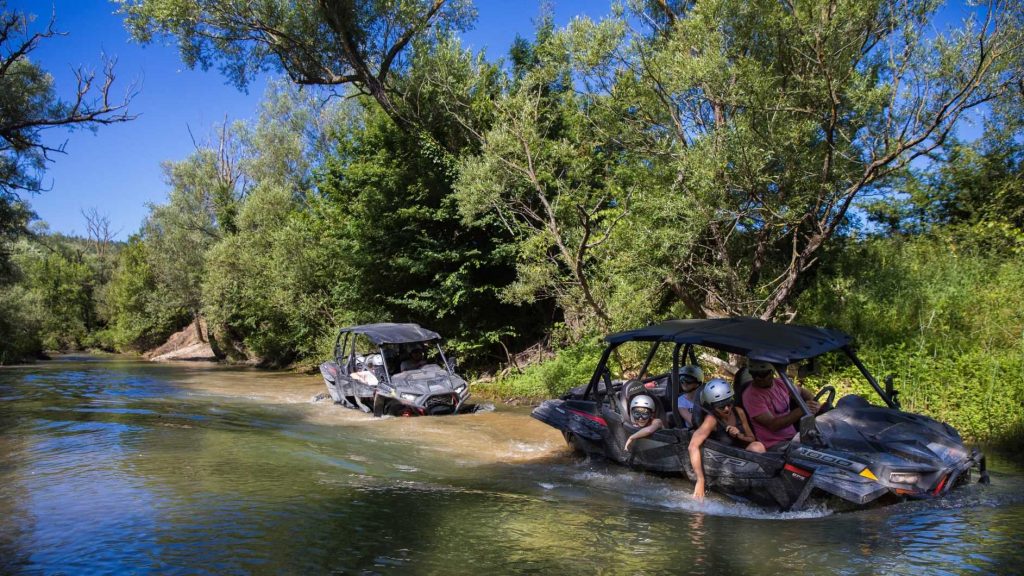
Buggy safari
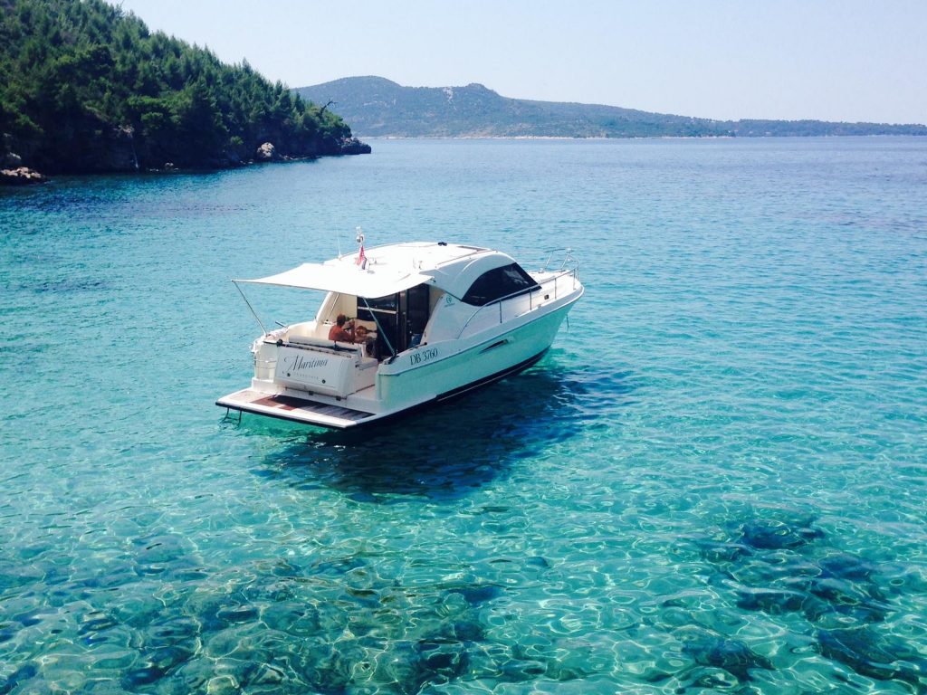
Coastal Tourism

Cycling
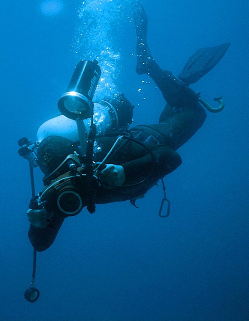
Diving
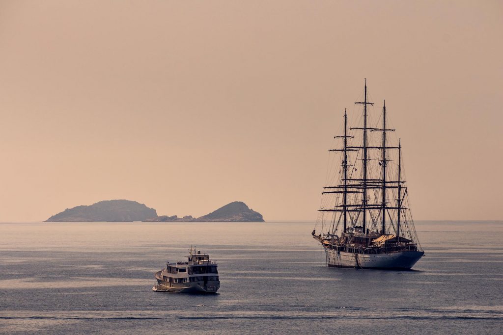
Excursions
Fishing

Hiking
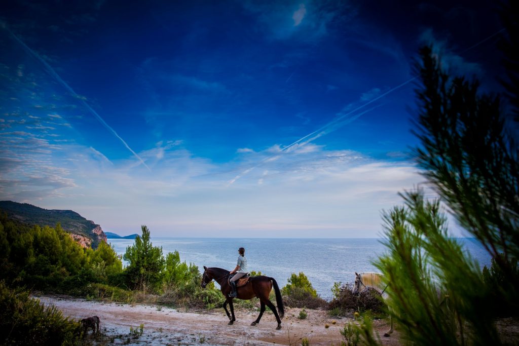
Horseback Riding